News and media
Regional Round Up: exciting developments on many fronts for Te Araroa
Far North
A 120 km trail from Ahipara, at the southern end of the west coast Ninety Mile Beach and Kerikeri on the east coast, began in March as part of a Conservation Corps programme. The agreed working area for the start of this trail was on an existing walkway, the Mangamuka walkway. Final agreement has still be be reached with DOC on a trail route which connects this walkway with Mangamuka Bridge. On its eastern side the trail has also to finalise a legal through-route from the existing Kerikeri River walk through to Highway 10, and some farming land beyond that to connect to Puketi Forest.
Waikato
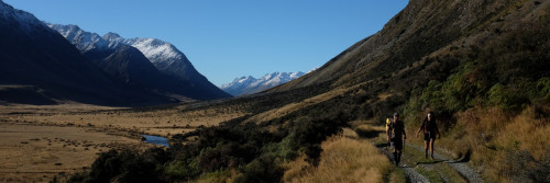
Te Araroa's route up the Waikato River is planned to extend south from the existing trail end at Rangiriri on stopbanks to Huntly. The Trust is currently seeking $70,000 to enable this trail to be put in. A route between Hamilton and the start of the Karamu Walkway, and a Back Country Adventurer standards track down the western ridge of Mt Pirongia to connect with existing horse-trekking routes through to Waitomo are planned.
Manukau City
A route that goes around Mangere Mountain through the Stonefields, sidles close to the International Airport for possible easy access onto the national trail with bike and hiking links for international back packers into both Auckland and, via Puhinui Stream into the Manukau City Centre is being put into the city's Park Strategy for 2001 - 2002 for public comment.
Auckland City
Te Araroa piggybacks on the Coast to Coast walkway across the peninsula. Te Araroa is included in pamphlets and its brand is expected to be on new signage the council is putting in.
North Shore City
The trail is expected to be signed through on the coastal walkway between Devonport and Okura Estuary sometime over the next year. Land for linkage from Long Bay to Okura for the council's Crimson Walkway is presently being acquired by council.
Rodney
The trail is designed to link between North Shore City and Rodney via the Okura Bush Walkway (DOC). Te Araroa Trust's Auckland regional co-ordinator is presently negotiating with DOC and Rodney District Council for a 50-km section of the trail through Rodney which goes from Pakiri Beach to Puhoi.
Wanganui
A trail between South Beach close to the Wanganui Airport, and the South Mole, part of a longer trail envisaged from Wanganui City south to the Whangaehu River is presently in the planning stages. The group pursuing this - a walkway committee of the Taranaki-Wanganui Conservation board - is presently seeking some funding and approval from the Wanganui District Council in the Council's 2001 - 2002 annual plan.
Wellington
Wellington City is preparing signage to take the trail into the city along its northern walkway route to Mt Kaukau. Two further land negotiations are required to take the trail north of the Mt Kaukau summit to Spicer Forest. Access to Spicer Forest and the Colonial Knob Walkway has still to be resolved with the forest managers, but is expected to be straightforward.
Colonial Knob then connects to the Raiha walk - already signed with Te Araroa symbols by Porirua City Council. The Council has designed a through route for the trail, and assigned priorities to its various stages.
Wellington Regional Council will sign the trail from Battle Hill through existing tracks in the Akatarawa Forest but the Trust still awaits development of a linking trail down through Landcorp's Whareroa property to exit at McKay's Crossing and join with the Kapiti Coast District council's urban coastal walkway/cycleway through the district. Estimated cost of the Whareroa link is $50,000 and a volunteer maintenance group is required for this section.
South Island Te Araroa Trust is still producing its proposed blueprint for the through trail in the South Island.